Amazing Features of a Mobile Satellite Images App
Using a mobile phone, one can track down imaging satellites that are currently passing a specific location with the latest mobile application. In the past, imaging satellites are used only to gather vital information about the earth’s surfaces and other parts of the universe.
Satellite imaging is proven to be an essential device used in monitoring environmental concerns such as climate, water sources, air pollution, and forest covers. Over the years, its importance on agriculture, geology, disaster management, regional planning, and climate change have so far been considered as very useful.
Track Down Satellites Near You
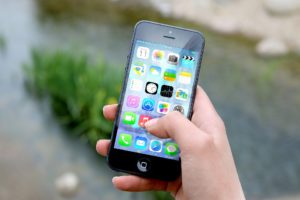 By downloading the application on Google App Store, satellites near your location can be tracked down and identified. You can even watch their trajectory and calculate their distance from where you are positioned.
With the app, notifications can be sent through your mobile phone that an imaging satellite is passing through your area. A notification is important so you can request tasks that you want to be accomplished by the satellite.
Ability to Task Imaging Satellites
With the latest app, you can access commercial high-resolution satellite imagery. Tasking satellites to take particular images is one feature that amazes users. You can get copies of these images because they will be sent directly to your phone.
With this app, selfies may soon have to take a backseat. You may do away with raising your hands into the air or having camera sticks to get an aerial photos of you. All you have to do is task an imaging satellite to have your picture.
Provides Situational Awareness
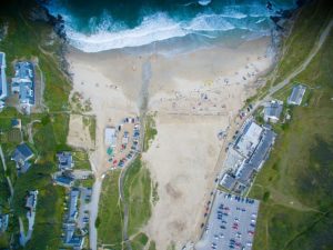 With comprehensive map graphic updates and high-resolution imaging on areas near you, you will be informed on impending environmental situations. You can even learn what is happening in other localities because you can configure which places you want to track.
This may be very important during times of calamities like extreme weather conditions. By tuning in to this app, you can stay away from heavily polluted streets in your city. Indeed, you can design proactive response combating ill-effects of an impending disaster with the use of this app.
Educational Benefits
Up-to-date information about the earth surfaces increases one’s knowledge of the planet we are living in. This makes us learn more about our environment, which can make us more responsible citizens.
With all the information we can get about the environment from imaging satellites channeled through our smartphones, it can have a very big impact on regional planning, disaster management, agriculture, and climate change mitigation which can be very helpful to individuals and communities.
This makes this app very relevant for our generation not only for its entertainment value but for much more important things.